El Seguro continues to consolidate its position as one of the most advanced exploration projects within Mendoza's mining initiative. A report incorporated into the environmental file currently under review by the Mining Directorate reveals that Impulsa Mendoza's project has completed a new geochemical and geophysical campaign, generating information that will support the development of the area's geological model and define the next stages of exploration.
By Panorama Minero
The project occupies a unique position within Malargüe Western Mining District I. It served as the leading project for implementing the technical, environmental, and administrative procedures that were later extended to the rest of the projects. Today, with its initial exploration campaign completed, it remains one of the technically most advanced projects within the provincial initiative, second only to El Perdido, the only project in the district that has already reached the drilling stage.
From Access Road Construction to Data Generation
When Panorama Minero analyzed the progress of El Seguro earlier this year, the project was focused on early-stage works, primarily the construction of the access road required to enable logistics for future exploration campaigns. The report now incorporated into the environmental file shows the next step in that sequence: the execution of the geochemical and geophysical work planned to begin building the project's geological model.
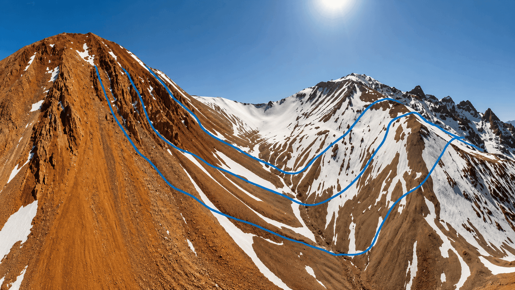
The campaign was carried out during March and April 2026 by the technical team from Impulsa Mendoza, the project owner, together with ALH Geofísica, and included geological mapping, geochemical sampling, and surveys using Electrical Resistivity Tomography (ERT) and Induced Polarization (IP), two techniques used to characterize the subsurface without the need for drilling at this stage.
Data Generated During the Campaign
Regarding geochemistry, the report states that 53 samples were collected, 46 of which corresponded to the April campaign. All material was prepared for shipment to the laboratory, incorporating blanks and duplicates as part of the QA/QC quality control protocol, together with the corresponding chain-of-custody procedures to ensure sample traceability.
At the same time, the technical team described the collected hand samples, organized the field material, and advanced the first interpretations of the two-dimensional conceptual geological model, which will serve as the basis for integrating the information generated during this stage.
For the geophysical component, Impulsa Mendoza had planned three 1,500-meter Electrical Resistivity Tomography and Induced Polarization profiles to investigate the subsurface to a depth of approximately 500 meters. During this campaign, Profile 1 was completed, ultimately reaching 1,530 meters in length and an investigation depth of approximately 630 meters, exceeding the original design parameters. It is important to note that this depth refers to the investigation capability of the geophysical methods and not to exploratory drilling.
The work enabled the acquisition of 3,600 resistivity and IP measurements. To achieve this, the team installed 72 electrodes, excavated shallow holes to penetrate the volcanic ash layer, and carried out quality control checks before each measurement to identify and repair any cable damage prior to data acquisition.
The report also reflects some of the challenges associated with high-altitude fieldwork. Completion of Profile 1 ultimately required seven days, compared to the four days originally planned. The reasons cited include access difficulties, field adjustments, electrode maintenance, steep slopes, the presence of ice, frozen ground, and adverse weather conditions.
The Next Stage
With this campaign completed, the project now enters the data processing and integration phase. According to the report, the next steps include receiving analytical results from the geochemical laboratory, incorporating the final geophysical processing, and developing a three-dimensional geological model that will integrate all available information to achieve a more accurate understanding of the mineralized system and guide future exploration decisions.
The evolution of El Seguro continues to set the pace for the exploration model that Mendoza aims to consolidate within Malargüe Western Mining District. After becoming the first project to be activated within the district and serving as the state-owned company's initial experience in testing technical, environmental, and administrative procedures, the project is now beginning to accumulate geological information obtained directly in the field. Laboratory results and the integration of geophysical data will reveal the area's level of potential and provide the basis for defining the next stages of exploration for what remains the second most advanced project within Malargüe Western Mining District.