Dr. Aníbal Altamira, from EICAM, identified the most suitable passes in Calingasta for connecting with Chile, highlighting La Chapetona (Azufre Norte) due to its low altitude and favorable climatic operability. The technical study proposes the Blanco River route as the most viable access to reach these strategic and complementary crossings.
By Panorama Minero
A comprehensive study conducted by the School of Mountain Road Engineering (EICAM) at the National University of San Juan analyzes the best alternatives for establishing a road connection between the department of Calingasta and Chile. The research, led by Dr. Aníbal Altamira, details the strategic passes that would allow overcoming the natural barriers of the Frontal Cordillera and the Main Cordillera.
Assessment of Mountain Sectors
To determine the most suitable routes, the team led by Dr. Altamira divided the region into three areas of interest: the Valle de los Patos Sur, the Río de las Salinas Valley—considered the most relevant sector—and the Valle de los Patos Norte.
In the southern sector, the study highlights passes of historical and touristic importance such as Valle Hermoso, Ortiz, and Las Llaretas, the latter used by General San Martín during his liberation campaign. In the northern sector, the passes of La Gloria and Doña Rosa were identified, although they present the technical challenge of being located at elevations above 4,000 meters.
La Chapetona Pass and the Advantages of Central Crossings
One of the key aspects of the EICAM study focuses on the so-called central passes along the Calingasta boundary, which offer competitive advantages compared to other international crossings. Among them, the Azufre Norte pass—also known as La Chapetona—is identified as one of the most attractive and suitable crossings for regional integration.
According to Dr. Altamira’s conclusions, these central passes—including El Soberado and the Laguna Overa variants—are not intended to compete with established routes such as Agua Negra or Los Libertadores, but rather to act in a complementary manner. Their technical advantages are clear: they have elevations comparable to Los Libertadores but experience fewer snow days per year due to their more northern location, and they are at lower altitudes than Agua Negra, ensuring greater year-round operability. These passes could undoubtedly support mining, tourism, and productive activities, strengthening integration with Chile.
Access Routes and Technical Feasibility
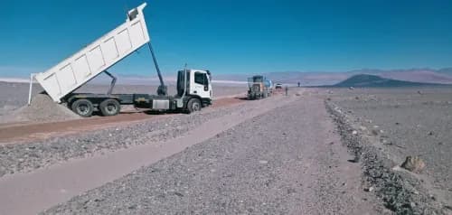
EICAM carried out a technical-economic evaluation comparing different access alternatives to these valleys. The study determined that the most viable route follows the Blanco River, passing through Santa Cruz and La Pantanosa before reaching the Salinas River. This route is superior to the Calingasta River option, as it only requires crossing the Urrutia pass (3,311 m), avoiding other routes that involve passes exceeding 4,000 meters in elevation.
The advantage of passes such as La Chapetona lies not only in their climate and altitude but also in their proximity to Chilean population centers and the existence of tracks that would facilitate rapid connection to the neighboring country’s road network. On the Chilean side, this pass leads to Monte Patria, in the Coquimbo Region. Currently, the School of Mountain Road Engineering continues to work on feasibility studies in collaboration with mining projects in the area to define the most efficient connections.